Sail plan for an Exciting week in the Exumas
After a long day of traveling your group has finally arrived in Nassau, and the adventure begins... TRANSPORT is very simple, as you exit the airport there is many taxis, mini vans and for the rich and famous ( or want to be's) stretch limos waiting to take you to your marina. They charge between $30.00 to $40.00 US per trip. The local drives are very pleasant and if you ask they will proudly tell you a little history of the islands. The ride takes you about 45 minutes and is a fun roller coaster ride. Your destination is Nassau Yacht Haven Marina Telephone: (242) 393-8173
The Navtours Base is found on East Dock, you can ask our base staff and they will be happy to direct you.
Upon arriving at your charter base, you will meet the customer service reprehensive. They will guide to your boat and help you get settled. Remember that Saturday is a very busy day, with customers coming and going. I suggest you settle in to your boat and save the list of questions till a little later. Get your crew to place there personal item in there rooms and take a moment to relax in the cockpit with a cold beer or rum punch. This will give you the time to discover your boat, prepare a few questions and decide who will do the groceries, wine provisions, ect... Your reprehensive will comes back around to see to all your needs, this is question time. I suggest you send two or three crew to do the provisions and a couple to buy the beer and wine. The captain then is free to spend an hour with the rep, reviewing the boats operations. Upon the return of your crew, you can now help to store the food and enjoy the time together; you are almost ready to go. We do most of our provisions at City Market; they offer a good selection of dried goods, fresh veggies and meats. Don't over look the frozen food section, many of your items can be found, already frozen. Avoid any frozen chicken that is square in shape, it has unfrozen and refrozen at least once and who knows for how long. You will find the prices, on certain items higher than home. I suggest comparing prices and brands, the costs can be quite different. You can always start with the fish market at Potters Cay, an exciting local market. The fisherman set up early each morning, with there fresh catch. Great deals can found, wonderful fish and shell fish.
TIPS ON THE GROCERIE SHOPPING.
You are shopping for a full week, so remember that convenience stores don't exist in the Exumas, and so bring more than less. If you where to forget an item, another boat will surely be able to help you out. I find we tend to eat or snack, more often than at home, so think of easy snacks for the day and evening. If the days sailing is in moderate to strong seas, you will want to have food prepared a head to quickly and easily feed the group. Some ideas, peanuts, corn chips, fresh veggies and dip, sandwiches, wraps, cold pasta salads and the list goes on... Some crew may not feel well on windy days and it is important to keep them warm, hydrated and lightly fed all day. I prepare food in advance each morning; this frees me from having to work in the galley in ruff weather. Zip locks and aluminum foil are a great time saver. An example, you can cut up fresh veggies into a zip lock and put a dip into a Tupperware for quick and easy serving. Fresh veggies are good fibre and full of water so a great snack choice on ruff days. Pita wraps stay fresh a very long time, compared to sliced bread. Prepare a wrap with greens and sliced cold cuts and wrap them up in foil, anyone can grab one out of the fridge when hungry. Well you are getting the idea, be prepared, especially with children aboard! A quick reminder, everything take twice as long to prepare on a boat, so if you are planning to serve a meal at a certain time add an hour to your usual prep time. If you have a little more time and you wish a small adventure, the local fish markets are great..
Children Aboard:
All boats have life vest but they are sized for adults. You must bring floatation devises, sized for your children with you! Also before leaving, insure that you have life lines on
board for each child I have two children and one on the way. They have sailed since they where infants and still enjoy the sport today. Children can't keep still for hours and hours so I have always set them up with a comfortable sized life jacket and a short life line. This permits them to move around safely and removes the stress that they may fall overboard. The rule onboard my boat is the following, when a child comes on deck they must have a life vest on and when on route
we add the life line This young sailor is two and half years old and loved his 14 day trip around the Exumas. As you can see, he is very comfortable and safe in his personal sailing gear. Remember to bring games and toys that are boat friendly. Beach time every day is always an important part of the activities, kids have to run around. Also think protective clothing, sun, wind, cold, affect there small bodies quickly. Children don't notice the affects the environment has on them until it's to late, SO BE PROACTIVE. I always keep a drinking bottle of juc on deck for the little ones, dehydration happens quickly in children.
The morning starts early, with the final preparations for departure. A healthy breakfast is a good idea, the crossing will take about six hours. The final check list as follows, fuel, gas for dinghy, top water tanks, safety gear, review boat equipment, secure the galley and food for the trip. The charter rep will assist you in leaving the dock and way you go, with the fleet to the Exumas. The lead boat will guide out of the harbor and past Atoll to Porgy rock waypoint. There is a few sand banks and coral heads, so follow the lead captain’s directions. From Porgy rock waypoint, it 29km to Highborn cay. Follow the maps preferred route, 136 degrees will take to Highborn Stake. A few hours out of Nassau you will be approaching the coral heads, marking the beginning of Yellow Bank. For the next five miles there is large coral heads and they must be avoided. This is far from as bad as it seems, the coral head stand out as large black masses on the crystal clear ocean. There are a few 100 yards apart and sometimes in small groups of three. I have a crew member posted at the bow, there responsible to point to any coral heads, directly in front of our path. The captain simply steers around the obstacle. Yes it is as simple as that... A few other details include, try to arrive at Yellow bank late morning. The higher the sun is in the sky, the clearer the water will be, also dull and cloudy days make the spots job a little tougher. The Bahamas is VNA (Visual navigation area) maps are good, cart plotter great but visual navigation is a must.
Magnified view, click on image and drag to move.
When on Yellow bank you will see many small coral heads, about 12 inches to 30 inches in diameter. These are small and safe to sail over. The lead captain will guide you threw and you will see it is simple. Two more hours on the sand bank and Highborn cay will be upon you. The first thing you will see, when your about five miles out is the radio tower. You will anchor off the beach, to the north of the tower. There is a large coral reef, starting at the north point of the island and coming west for about a mile before hooking north. Yes please go around it, via the south! The approach to the anchorage is from the south west.
Start your approach from Highborn Bore way point, on your GPS chart plotter,. N24 42.372 W76 51.998 . Heading should be due east 88o, as you approach the anchorage, about 1.5km east, you can start turning north east and approaching the beach. You can approach quite close to the beach, water depth is around 15ft. sanding bottom will provide a good hook. The tidal current is quite strong, running parallel to the beach, at 5knts. Don’t be surprised that your boat, rotates opposite to the wind direction. I have found myself, sitting on top of my anchor on many occasions. Bahamian Style anchoring will secure your boat and let you get good nights sleep.
Alan’s Cay is just north of your anchorages; a short dinghy ride will take you back to see some of the oldest animals on earth. The iguanas enjoy visitors so bring them some fresh fruit and they will come right up to you.
Your next stop will be Wardwickwells, Marine Park. This is a 20km. trip due south. Exit Highborn Cay on the same route you used on your approach. There is a shallow reef to the south, so I recommend staying on a westerly direction until Highborn Bore, there you arrive on the suggested route south.
N24 42.372 W76 51.998, head south at 180o. This route will take you past Normans Cay; give a wide berth to Normans Cay stake. Stay well to the west of the stake, it is a very large and shallow sand bank, that tends to move with the tides.
The suggested route changes direction slightly and will take you past Shroud Cay and Hawksbill Cay. As you approach Wardwickwells and Long Rock Bore N24 21.299 W76 42.097 keep a close eye open for the Bahamas sand Banks. Stay on the charts suggested route.
There are two approaches for Wardwickwells Marine Park. The North mooring field, in the J cut or the West moorings at Emerald Rock. As you approach the Marine park, you must call them for a mooring assignment. Hail the Park office on ch 16, they will request your vessels information and assign you a mooring number. Both approaches are between sand banks and is a VNA area.
The North moorings are accessed from Long Bore way point, N24 21.299 W76 42.097. You will proceed 56o NE along the suggested route, until you will see on the starboard side the red and green markers to the entrance to the mooring field. Check your tidal charts, the J cut has a strong current when the tides are going out or coming in. If you combine that with a strong NE wind the approach will require an experienced captain. The cannel is narrow and with the current, makes picking up a mooring, challenging.
The West mooring field at Emerald rock offers better protection and has no current. I have picked up a mooring single handed on many occasions at Emerald Rock. The approach to Emerald Rock is a couple of miles South of Long Bore, at Waypoint N24 21.065 W76 38.889. From this point it is East at 24o, keeping the sand bank to the port side and the exposed rocky reef to starboard. Continue towards the bay and you will see the two white marker balls, at the beginning of the field. Stay between the balls and enter the mooring field.
After you are settled, take a dinghy ride to the office to pay our mooring fees. Wardwickwells offer several hiking trials, reef snorkeling and the best sunsets in the Exumas. Just west of Emerald Rock are three red mooring balls. They are marking three beautiful reefs that are a must to explore. Just tie your dinghy up to the mooring and enjoy the marine park. We will spend a couple of days at the park, enjoying all it has to offer.
From the parks office you can hike to BooBoo Hill. Look out at the powerful Atlantic Ocean, great views, from the top. There are blow holes in the lime stone, a memorial of the sailors and vessels that have visited over the years and interesting natural wells on the trail. The short trail takes a couple of hours to complete, ware good walking shoes. BooBoo Hill
Look Out Visa
Hiking Trails
North Mooring Field
Your next stop is Hawksbill Cay, a short 15km ride to the North. If you are planning a two week trip, you would continue South toward Staniel Cay area. See the extended two week trip, the Southern portion of the trip at the end.
Follow the recommended route north, always keeping the Bahamas Sand Banks to starboard. Heading north past Cistern Bore to Hawksbill approach, Stay to the north of the sand bank and use a heading of 66o, begin your approach from way point N24 27.320 W76 47.806. If you time your arrival at high tide, you will find it much less stressing as you approach the Cays shallow waters. The first mooring you will see is a large vessel mooring, west of the mooring field, in deaper waters. A reference point on the island is the small hill, keep heading towards it’s direction.
The Cay offer hiking trails, beautiful vista’s , snorkeling, incredible fine sand beach ( best in the Cays ) and deserted beaches. You will feel like you are alone in the world.
The next Cay to the rock is Shroud Cay. A great stop over on your way north. The mooring field is on the western side, this side of the island has a rocky shore line and no beaches. But adventure awaits you at Shroud Cay. Pack a lunch, power up the dinghy and you are off the explore Blue Lagoon. A quick ride, following the shore line to the north of the island, where you will find the entrance to a shallow river.
Slowly navigate the river until it opens to a spectacular lagoon. A great spot for a picnic, swimming and R&R. The river is easier to navigate at high tide. Take note that the two other rivers are off bounds, they are nurseries for many types of fish, please do not disturb.
The next stop, we go back to the years of Miami Vise and the Colombian drug lords. Norman’s Cay in the 1970’s was the base for the importing of cocaine from Colombia. It became there private play ground until the US government put a sudden end to there activities. In 1982 the Us marines attacked the island and shot down a DC10 in the invasion. The homes and building are still there to visit,
but are deserted. The DC10 crashed into the SE lagoon and is a popular
snorkeling site, as it now is a home for a host of marine life. Normans Cay Bar & Grill is a must stop, this wonderful island grill was know for years as Mcduff’s, until a few years ago it went threw a total renovation and is now ready to serve you. In traditional Key West style, come pass a few hours on there covered gallery, looking out over the Bahamas Bank. Fantastic local dishes and friendly staff make for a perfect evening.
As you come around Shroud Cay way point, you have to decide on your anchorage for the evening. Either in Normans cut or on the sand bank in front of Normans Bar and Grill. No moorings at Norman’s Cay so you will be wetting the anchor tonight. If you have a Northerly to Westerly breeze the Norman’s Cut is your best choice. Anchoring in the Cut requires a certain experience so let’s review in detail the procedure. The cut has a 5 knots plus current running threw in a westerly direction, as the tide is coming in and an easterly direction as the tide goes out. You must anchor in Bahamas Style in the Cut, if not you will be pushed all over the bay. Drop your main anchor to wind and set it firmly in the sand. Back up 150ft to 200ft off your primary anchor, along an east west parallel. Drop your secondary anchor and bring in you primary anchors rode, until you are centered between the two anchors. Use an anchor ball, docking bumper or life vest to mark each anchors position. Once you are in position, mark a way point on your GPS, which will permit you to check your movement in the current.
I leave the GPS on, for the night to have a quick reference. Now the last thing to do is get in the dinghy and go inspect the two anchors to be sure they are well hooked in the sand. If they are not well snorkeling time, dive down, place the anchor and set it manually in the sand. If al the maneuvers are a bit much for you, here is a second way to proceed. Hook your first anchor to wind and set it firmly. Bring the dinghy around to the front of the vessel and gently place the secondary anchor and chain in the dinghy. Leave about 20 ft of rope loose in the water. Drive the dinghy slowly towards your second anchor site, letting out chain as you go. Once most of the chain is out, drop your anchor and check it is correctly placed in the bottom. Return on board and collect all the extra rode. When the tide turns the anchor should set itself. Check to be sure it is set. Leave about 10 ft of chain loose on the secondary anchor to permit the boat to turn. Sweet dreams.
If the wind is north to South the bank is a great option. Follow the recommended route from Shroud Cay way point. You will pass between two sand banks and take a wide turn towards the beach. There is ample space to anchor in the bay and let out 100ft. of chain. A short dinghy ride to the beach to explore the island and visit Norman Bar & Grill.
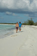
Normans West beach
Normans Bar & Grill Terrace
Time to head for Nassau, from Normans it is 39knt miles. You should plan to be back by 4pm, before dusk. The Base staff will be waiting for you. As you approach the marina call the Navtours base on channel 72 for docking instructions. If the weather or your comfort level is uncertain, a base crew member will dinghy out to meet you and assist you in docking the vessel. You have just had a wonderful vacation, lets not ruin it with an accident docking. Docking at Yacht Haven is a little tricky, when the wind is at the party. The wind and currents will affect our boat as you approach, so do not hesitate to ask for assistance.
Welcome Home